
our services


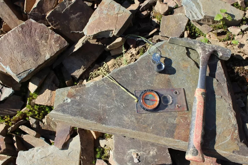

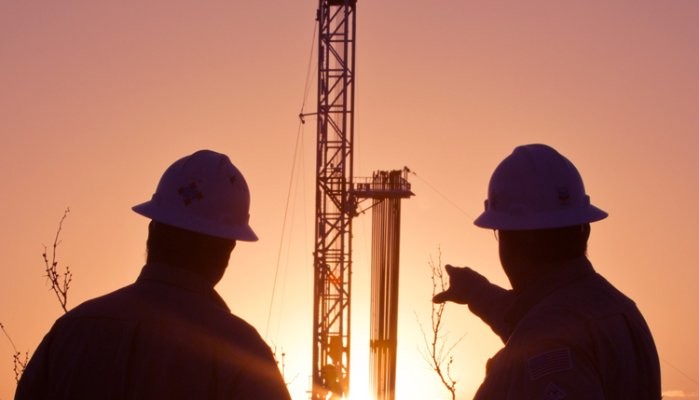
GEB is an integrated exploration and service company with global capabilities. Comprised of a diversified management team with unmatched worldwide experience, GEB has the knowledge and ability to handle any challenges involved with Land 2D/3D seismic exploration. .
GEB is committed to exceptional customer service, superior data quality, innovation, and integrity while maintaining a focus on health, safety, and environmental stewardship.
We supply seismic solutions including,
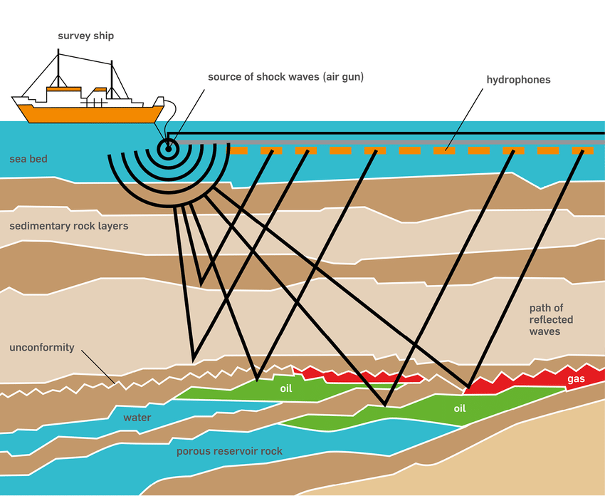
• 2D/3D ONSHORE AND OFFSHORE SEISMIC DATA ACQUISITION,
• 2D/3D SEISMIC DATA PROCESSING.
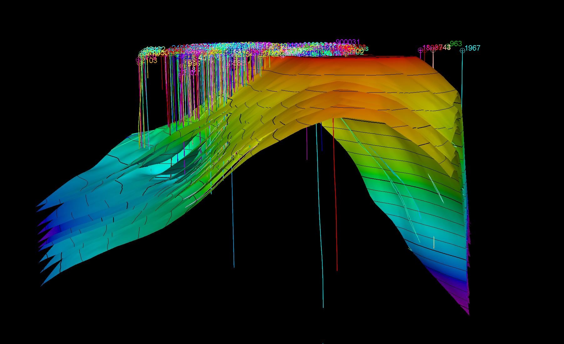
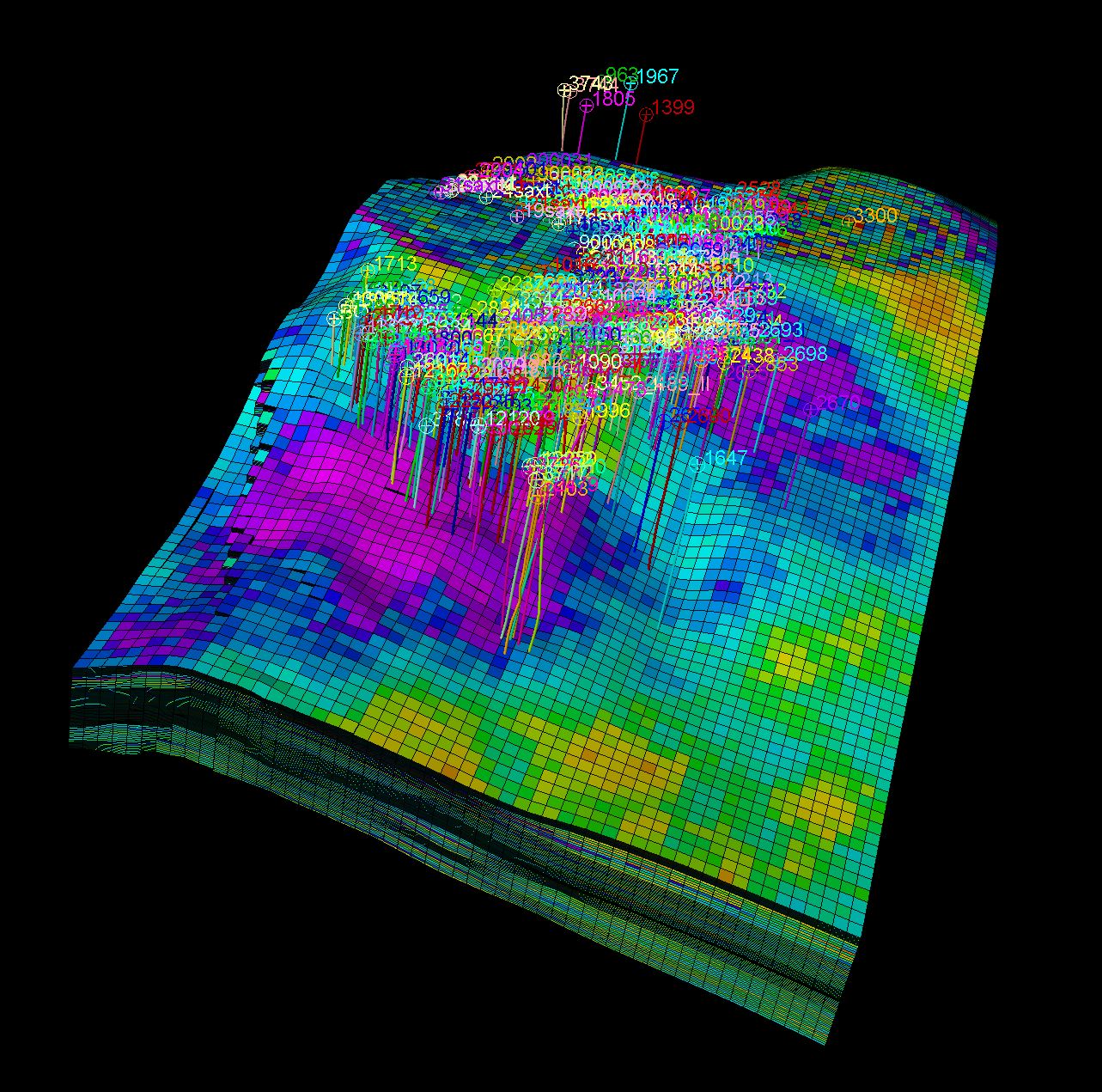
Geoengineering MMC Services performs works for 3D geological and hydrodynamic model building.
Our experts have many years of experience in oil&gas fields three-dimensional geological models building based on seismic 2D and 3D modifications in conjunction with well logging data and all available geological and geophysical information within the research area. Within the framework of the contract works, both static and dynamic modeling of oil and gas fields are performed. Due to the fact that static geological modeling allows for more reliable positioning of production and exploration drilling, performs more accurate calculation of reserves, and carries out risk assessment, our specialists in the course of complex works perform static modeling for each project, even if it is not prescribed separately by the geological and technical tasks of the project.
On the basis of the prepared reliable geological (static) model of the investigations area, in the presence of the tasks from our clients, our specialists build a hydrodynamic (dynamic) model of the research area in order to create and confirm projects for the development of hydrocarbon deposits fields. Due to the partnership with leading partner companies and international Advisory groups of experts, our specialists solve any tasks assigned to them and our results always achieve their goals.
To build geological and hydrodynamic models, our specialists use software from leading world leaders such as Petrel, ECLIPSE (Schlumberger), Irap RMS, and Tempest MORE (ROXAR).
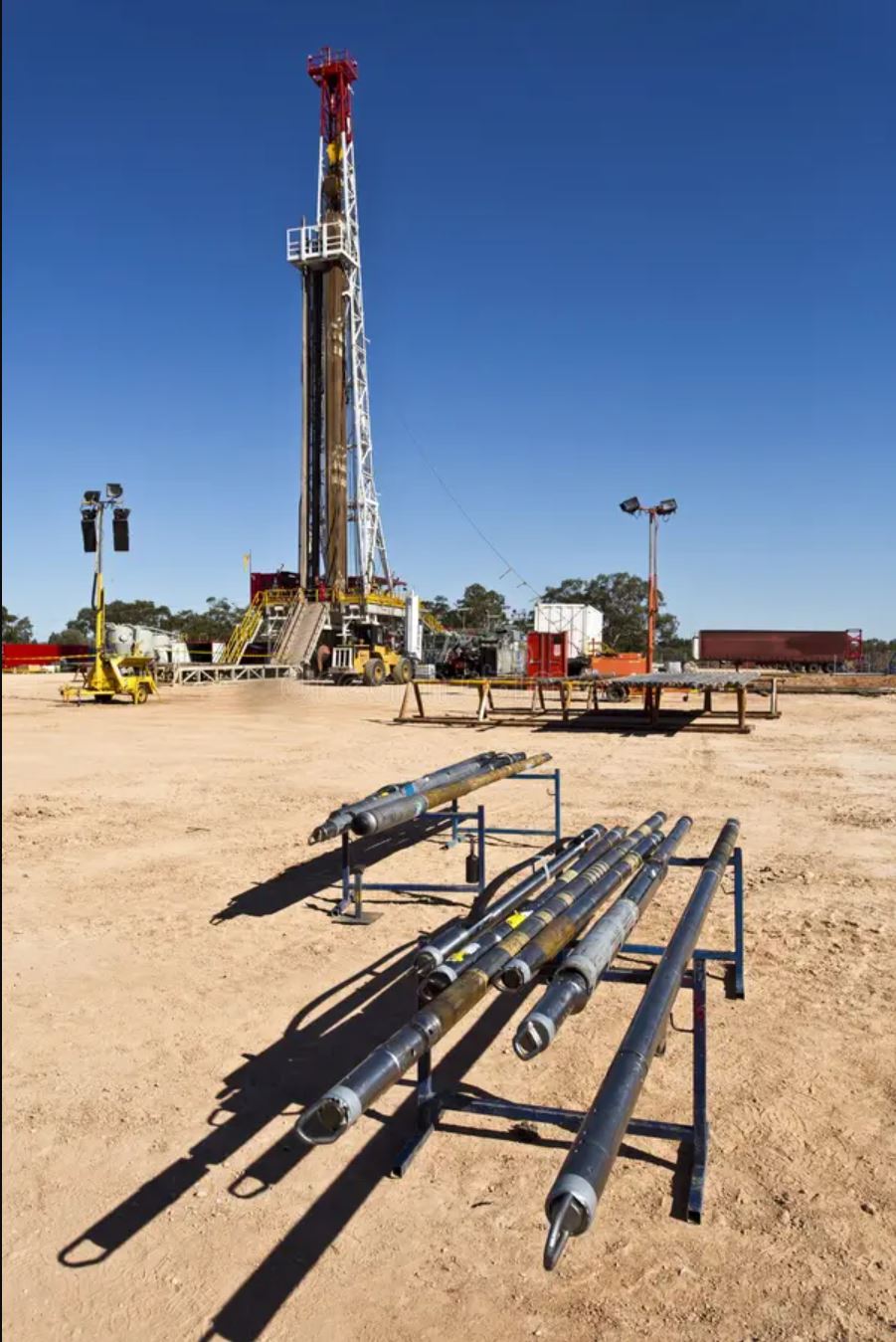
It is impossible to ensure the intensive development of oil fields and the abundance of oil extracted from the field only with natural reservoir energy. In order to achieve a higher oil yield rate and the rate of oil extraction from the productive layers in the oil field, formation pressure maintenance methods are utilized; namely, water and gas are injected into the formations with high pressure.
Based on the analysis of the results in the initial phase during the implementation of the project, a phased principle of the implementation of processes in the next continuation of the project can be established. The next roadmap for the processes can be prepared by starting with a partial implementation. By doing so, we can assess the initial results before the project is fully operational and determine the operational area to check the effectiveness of the application of the process.
For our method, the first step is to create a 3D model of the oil field. The creation of a geological 3D model, including underground geological features in 3D format, involves the use of special software and geospatial data. Here's an overview of the steps involved in creating a geological 3D model: gathering geological information such as well books, coordinates, geological maps, cross-sections, and structure data. Initially, building the structural model requires a high degree of accuracy, as it forms the skeleton of the next stages. Once the structural model is established, we proceed to build a 3D grid model, adapting its dimensions to the oil field. Later, facies, petrophysical, and water saturation models are constructed. The defined network facilitates water injection by choosing the right areas with the help of cuts in the model.
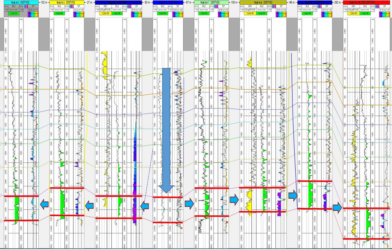
In the project's implementation, it's imperative to choose the right wells. We have well books and well passports stored electronically, which aid in reviewing wells and logs with compiled data. Regular visits to oil fields and well sites are necessary to clarify problems and questions. After choosing the right wells and area, the most crucial part begins: injecting water into a productive oil well in the chosen area. Over time, productivity can be obtained from the surrounding wells.
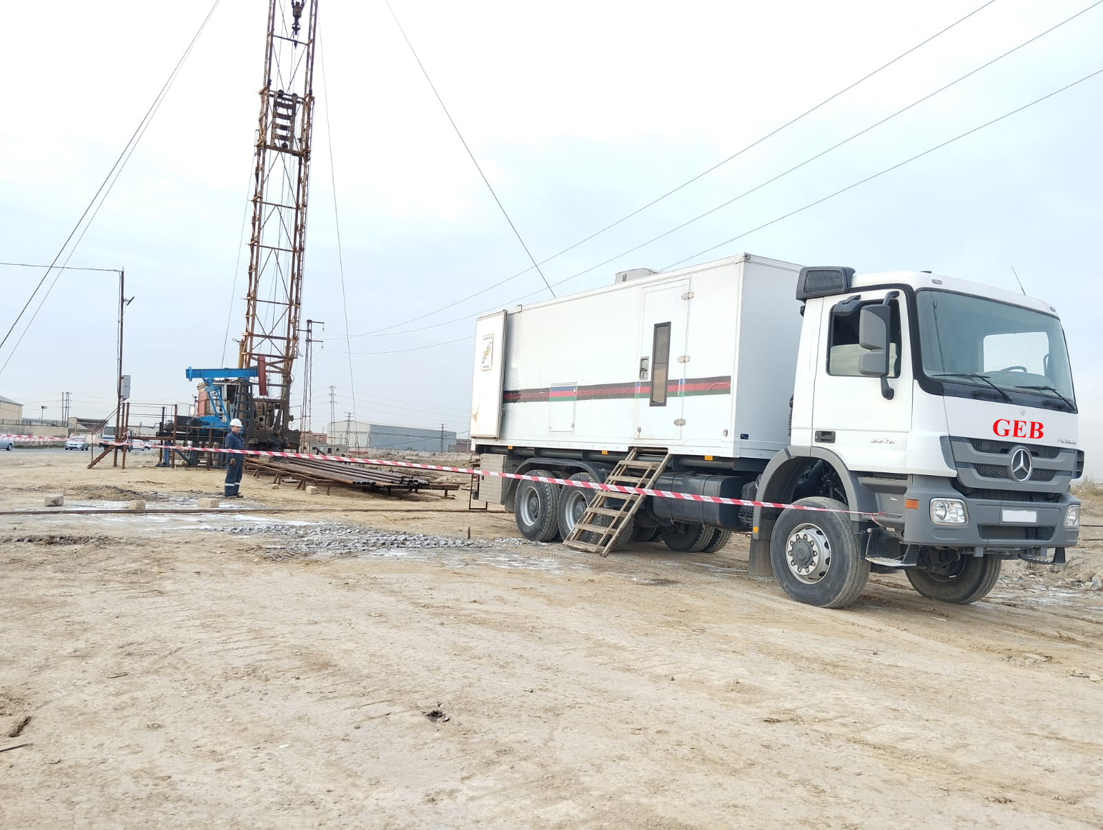
GEB is a leading provider of geophysical logging services to the mining, geotechnical, water infrastructure, and environmental markets. We combine our extensive experience, critical thinking, and the latest technological advances with standard logging techniques to create downhole geophysics capabilities unmatched in the industry.
Open Hole Logging:
- Cross Dipole Array Sonic
- Imaging
- Array Induction
- TPL
- Triple Combo Logging including:
- Gamma Ray
- Natural Gamma Ray
- Compensated Neutron
- Micro-Spherical Focused Log
- High Definition Sonic
- Dual Laterolog / Induction
- Four-arm Caliper
Cased Hole Logging:
- Multi-finger Caliper
- Electromagnetic Thickness
- CH resistivity
- Neutron LifetimeLogging
Logging While Drilling (LWD):
- Directional Survey & Telemetry Logging
- CNP Neutron Porosity
- WPR Wave Propagation Resistivity
- GIR Azimuth Gamma Ray & Induction Resistivity Logging
Oil and gas IT solutions help the industry embrace digital transformation to improve drilling quality and efficiency, optimize reservoir management, and oil production, reduce operating costs, and more.
Advanced transactional analytics:
- Data collection and storage (including reservoir and well data).
- Operational alerts, performance forecasts, and operational risk assessments.
- Operating cost analysis.
- Analysis of the effectiveness of capital projects.
- Intelligence development analytics.
- Supplier analytics.
- Drilling analytics.
- Analysis of equipment performance and failures.
- Personnel analytics.
- Health, Safety and Environment (HSE) Analytics.
- Supplier management
- Management of risks.
Purchasing/supply management:
- Supply assessment and management.
- Supplier risk management.
- Supplier portals.
- Inventory Management.
- Automation of purchase orders.
- Integration with project management and support processes.
In addition, we offer you the purchase, download, maintenance, courses, and other services of software programs for the oil and gas sector.
Our specialists with high knowledge and experience will provide you with the necessary knowledge and skills in the Oil and Gas sector. On request, courses can be held at our training center or at your workplace.
Sectors we offer:
• Sedimentology
• Sequence Stratigraphy
• Petroleum Geology
• Geological and hydrodynamic modeling
• Geostatistics
• Formation Evaluation / Petrophysics
• Reservoir Engineering & Simulation
• Production Engineering & Management
• Drilling Engineering
• Enhanced Oil Recovery
• Thermal Lining, insulation, and concept of refractories.